
The east of Mauritius
The east of Mauritius, where the sun rises and where the island began
 The essentials in a few words
The east of Mauritius extends from Poudre d'Or to Pointe d'Esny, across the districts of Flacq and Grand Port.
This is the windward coast: the southeast trade winds arrive there first, and the sea is more lively.
Here you'll find the island's longest white sand beaches, between Belle Mare and Palmar, Île aux Cerfs and its boat trips, the Grande Rivière Sud-Est waterfall, a very peaceful national park in Bras d'Eau, the fortified islets of Grand Port Bay, and all the heritage of the southeast: the ruins of the first Dutch fort in Vieux Grand Port, the Mahébourg Museum
Few cities, little hustle and bustle, lots of space.
Day breaks here before anywhere else. At six o'clock, the Belle Mare lagoon is still milky, the white line of the reef is visible in the distance, and the wind, the one that never truly stops on this side of the island, is already beginning to bend the casuarina trees. A few kilometers of almost empty sand, canoes pulled up onto the beach, a van unloading lobster pots in front of a village just waking up: the east doesn't put on a show, it rises quietly.
This is the coast least visited by tourists, yet it's where it all began. In 1598, it was these reefs that Dutch ships rounded before anchoring in Grand Port Bay, and it was there, forty years later, that they laid the first stones of a fort whose ruins can still be visited today. Between this southeastern cradle and the coconut palms of Poudre d'Or, the east boasts the island's longest beaches, a national park that almost no one knows about, a small Creole town that has witnessed three colonizations, and an easterly wind that defines the character of the area.
Summary
- In short: the east coast
- Gold dust and the northeastern tip
- Roches Noires and Poste Lafayette
- Bras d'Eau National Park
- Belle Mare and Palmar, the large beaches of the east
- Trou d'Eau Douce, île aux Cerfs and the Grande Rivière Sud-Est
- Old Grand Port, where the island began
- The islets of Grand Port Bay
- Mahébourg, the small town that has seen it all
- Pointe d'Esny and île aux Aigrettes
- Wind, sea and water sports
- Practical advice
- Frequently Asked Questions about the East of Mauritius
- Photos
In short: the east coast
The east of Mauritius is the side exposed to the trade winds, those regular east to southeast winds that sweep across the Indian Ocean. This is the dominant feature of the entire region, and it explains almost everything else: a rougher sea beyond the reef, cooler afternoons than elsewhere, a lagoon that loses two to three degrees when the wind picks up, and a coastline that has remained sparsely developed because people don't settle there for leisure without a breath of air.
The wind strengthens during the southern winter, from May to October, and particularly in July and August. Bulletins from the Mauritian Meteorological Service commonly report easterly winds of 20 to 25 km/h with gusts of 50 to 60 km/h in exposed areas, and rough seas off the reefs. During the southern summer, from December to March, the trade winds weaken, the heat intensifies, and the same wind becomes a blessing: at Belle Mare, one can breathe while the west coast swelters.
However, one should be wary of the image of a uniformly windy coast. The coastline is not a straight line: headlands bear the brunt of the wind, bays and coves further inland much less so, and the exposure of a single beach changes throughout the day. The best course of action is to move a few hundred meters rather than giving up.
Administratively, the east covers the maritime front of the Flacq district and that of the Grand Port district, with its northern tip extending into Rivière du Rempart, near Poudre d'Or. The south of the island begins after Pointe d'Esny: Blue Bay, Le Bouchon, and Souillac belong to a different sector. To locate the whole area, see the geography of Mauritius and the portraits of north, of center and the west.
Gold dust and the northeastern tip
Poudre d'Or marks the beginning of the east coast, where the shoreline turns from north to due south. It's a large fishing village with no hotels or developed beach, just a promenade facing the sea, boats beached on the grass, and a horizon of islets. People don't come here to swim; they come because it was off these reefs that the most famous ship in Mauritian history sank.
The Saint-Géran Memorial
The poudre d'Or Memorial commemorates the sinking of the Saint-Géran, a ship of the French East India Company that was wrecked on the breakers during the night of August 17-18, 1744, resulting in nearly one hundred and eighty deaths. The tragedy inspired Bernardin de Saint-Pierre's novel Paul and VirginiaPublished in 1788, This book brought the island to the attention of All of europe. the monument, a granite pillar bearing the names of the victims, was Erected in 1944 for The bicentenary. admission is free.
We visited in 2024: it's not a spectacular site, and you shouldn't expect any staging. It's a quiet place, facing the sea, where you can walk for twenty minutes while reflecting on what happened there. Details of the events, the conflicting sources, and other Mauritian locations linked to the myth are gathered on the dedicated page. memorial to the sinking of the Saint-Géran.

The memorial to the sinking of the Saint-Géran
The Spiritual Park at Pointe des Lascars
A few minutes away, the Spiritual Park of Pointe des Lascars it occupies a rocky promontory jutting out into the ocean, with Hindu statues and shrines facing the open sea. The site, inaugurated in 2002, honors the memory of the indentured laborers from India—the "lascars" who gave their name to the promontory. It is not a tourist attraction, but a frequently visited place of worship: dress appropriately, be discreet with your camera, and be prepared for strong winds on the rocks.
Roches Noires and Poste Lafayette
Between Poudre d'Or and Bras d'Eau Park, the coast becomes decidedly wild. Roches Noires and Poste Lafayette form a coastline of dark basalt, small coves, and narrow strips of sand, battered by a relentless wind. Few shops, a handful of holiday homes, and scattered villas: it's one of the least frequented areas of the entire Mauritian coast, and that's precisely what people come here for.
The subsoil is riddled with lava tunnels, formed when the crust of a lava flow solidified while the lava continued to flow beneath it. black Rocks caves these are one of the few remaining accessible witnesses to this volcanic history. The site is not equipped with lighting and handrails: closed shoes, a flashlight, and caution are essential, and being accompanied by someone familiar with the area is the best way to visit.

Poste Lafayette beach is better suited for a stopover than a long day of swimming: the wind is almost constant and the seabed is uneven. It's a beautiful stretch of coastline for walking, picnicking, and watching the sea work on the reef.
Bras d'Eau National Park
Bras d'Eau National Park is the second terrestrial national park in Mauritius and the most discreet of the three: proclaimed on October 25, 2011, in accordance with the Wildlife and National Parks Act of 1993, it covers approximately 497 hectares near Poste Lafayette and encompasses two reserves, Bras d'Eau and Mare Sarcelle. It is free to visit, very sparsely populated, and bears no resemblance to the Black River Gorges: here, there are no panoramic views, no steep inclines—just flat forest, wide paths, and profound silence.
It's important to know what to expect so you won't be disappointed. The majority of the forest cover consists of old plantations of introduced species—mahogany, eucalyptus, and tecoma—planted after the destruction of the native forest. The site's true value lies elsewhere: in the remaining pockets of native vegetation, the rare orchids and ferns, and especially the birds. Bras d'Eau is home to one of the best populations of the Mascarene parrot, a small endemic bird rarely seen elsewhere, and ornithologists come here specifically to see it.
Mare Sarcelle, the park's large body of water, covers nearly 89 hectares of mangroves and mudflats where migratory birds stop over. Its name tells the story of a disappearance: the Mauritius teal, the bird that gave the park its name, became extinct more than three centuries ago. The forest also conceals two-hundred-year-old ruins, the remains of a sugar mill and a lime kiln, and the park is home to the Mauritius radio telescope. Practical details, trails, and access information can be found on the park's website. bras d'Eau National Park ; there bras d'Eau public beach is just a few minutes away to finish the morning.
Belle Mare and Palmar, the large beaches of the east
This is the seaside heart of the east coast, and the only place on the island where you can walk for so long on the sand without encountering anything but casuarina trees and the lagoon. From Belle Mare to Palmar, several kilometers of white sand stretch between the coastal road and a very wide lagoon, protected by a reef that can be seen in the distance as a continuous line of foam. The morning light is superb there, before the wind picks up.
There belle Mare public beach is the most well-known: large, open, with areas shaded by casuarina trees and plenty of space even on Sundays, the day when Mauritian families settle there for the day. A few hundred meters further south, the palmar public beach is narrower and considerably quieter. Between the two, large hotels occupy part of the seafront, without ever closing access: in Mauritius, all beaches are public.
One practical point to know before choosing to stay here: outside of hotels, the restaurant options are limited around Belle Mare and Palmar. Without a car, you'll eat where you sleep. This is the exact opposite of what makes the place so appealing—the space, the peace and quiet, the lack of hustle and bustle—and it's a factor to consider before booking, as the guide explains. which coast to choose for your holidays?.
A little inland, the village of Centre de Flacq hosts one of the island's largest open-air markets, particularly lively on Wednesdays and Sundays. It's the perfect outing for many holidays in the east: an hour of fruit, vegetables, spices, and conversation, just twenty minutes from the beach. See the article on... markets and bazaars of Mauritius.
Trou d'Eau Douce, île aux Cerfs and the Grande Rivière Sud-Est
Trou d'Eau Douce is the liveliest village on the east coast, thanks to its neighbor, Île aux Cerfs. Boats depart all day from its pier and from the one at Pointe Maurice, a little further south. The village itself has retained its fishing port character, with its colorful boats, its chapel, and a few tables by the water; it is said to take its name from a freshwater spring flowing into the lagoon.
Deer Island
Île aux Cerfs is the most visited site in Mauritius, and the excursion that forms the basis of almost every stay in the east. White sand, water where you can see your feet, casuarina trees that truly shade the beach, water sports, beach restaurants in the north, and golf courses covering the entire southern half. The crossing takes about ten minutes. Two routes exist: the official shuttle and the village's private boats, with different fares and jetty locations. All the details, including what has changed since the channel to Îlot Mangénie silted up, are in the dedicated article. deer IslandFor the full-day package with lunch on board, see the...catamaran excursion.
The waterfall of Grande Rivière Sud-Est
The Grande Rivière Sud-Est waterfall plunges directly into the estuary, a short boat ride south of Île aux Cerfs, and is one of the island's few waterfalls that can be viewed from the water. You travel up a narrow, steep-sided river channel, bordered by dense vegetation where macaques are often seen, to a pool where boats take turns—in high season, you have to wait your turn. Almost all excursions to Île aux Cerfs stop here.
The figures vary depending on the source: the Great Southeast River is given as 30 km long by some and 34 km by others, and the height of the falls varies from 10 to 15 meters according to different publications. No official source provides a definitive answer. What is certain is that the flow rate changes considerably from one season to the next: impressive after heavy rains, it can be modest at the end of the southern winter.
Old Grand Port, where the island began
Vieux Grand Port is the first inhabited place on Mauritius and one of the country's most important historical sites. It was here, in a deep, sheltered bay, that the Dutch settled, the first stones were laid, and the naval battle of 1810 took place, a battle whose memory is even reflected on the Arc de Triomphe. The village today is tiny and easily missed; you have to make a conscious effort to stop and explore it.
1598, the Dutch and Fort Frederik Hendrik
The Dutch reached the island in 1598 under the command of Admiral Wybrand Van Warwijck and named it "Mauritius" in honor of Prince Maurice of Nassau. Permanent settlement, however, did not begin until 1638, in the same bay, and Fort Frederik Hendrik was built there shortly thereafter. The Dutch definitively abandoned the island in 1710; the French, arriving in 1715, preferred Port Louis and left the site to its slow ruin.
The site is a listed national heritage site and admission is free. The museum, opened in May 1999 in a building dating from the French period, displays the finds from archaeological excavations carried out on the site—notably the campaign conducted between 1997 and 2003 with American and Dutch researchers, which uncovered Dutch layers some fifty centimeters beneath the French structures: ceramics, clay pipes, cannonballs, and everyday objects. In the park, visitors can explore the remains of the prison, the bakery, the forge, and the main building.
Let's be Honest: it's not spectacular. there Are no reconstructions, no modern scenography, and you can see the whole site in an hour. but it's The only place in mauritius where You can touch the first page of its history, and the model at the entrance helps you understand what you're looking At. all the details are on the website. fort Frederik Hendrik and its museum.
The battle of Grand Port, august 1810
The Battle of Grand Port took place from August 20th to 27th, 1810, in the bay visible from the fort. Everything hinged on the entrance to the lagoon, on a tiny strategic point: thepass IslandThe island, fortified by The french, first fell into british Hands, who used it to lure their adversary into the bay. This proved disastrous. the French squadron commanded by Guy-Victor Duperré defeated josias rowley's british squadron, which Lost Four frigates. this is the only French naval victory inscribed on the arc de triomphe in Paris. however, It Changed nothing in the outcome: a few Months later, the british landed in The north and captured the island. the Full account is in the article published for the 215th anniversary of the battle of Grand Port.
The islets of Grand Port Bay
Grand Port Bay is dotted with islets, and it's one of the most interesting excursions in the entire east: what tour operators call the "Five Islands of the Southeast Cruise." You leave Mahébourg or Blue Bay in the morning, sail among the reefs, stop for snorkeling, land on rocky islets where only ruins and birds remain, and return in the late afternoon with the feeling of having seen a different Mauritius. It's a beautiful day, and it tells the story of the country's military history in itself.
Fouquets Island, or Lighthouse Island
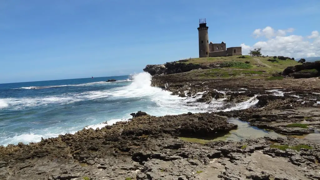
Fouquets Island is the islet with the ruined lighthouse visible from Mahébourg, perched on the reef at the entrance to the bay. The lighthouse, 26 meters high and built under British administration in the mid-1860s, has long been abandoned and is a national heritage site; the islet itself, approximately 250 meters long, is part of the country's protected areas. Walking here feels like walking between two worlds: the smooth lagoon on one side, the ocean crashing against the reef on the other. Details are available on the [website/page name].fouquets Island.
Pass Island
Passe Island is the small fortified islet that controls the entrance to the bay and was the starting point of the 1810 battle. The remains of the batteries, barracks, and cisterns can still be seen there, with explanatory panels on site. A word of warning: landing is very challenging, as there is no pontoon and the boat is exposed to the surf. It's not a stopover for everyone—but it's the only place where Mauritius' naval history is recounted with your feet in the water. See the page of thepass Island.
Vacoas Islet
Vacoas Islet completes the trio, nestled between Île de la Passe and Île aux Fouquets. It has neither monuments nor developed beaches; people come for what lies beneath the surface: coral gardens and reefs renowned for snorkeling, in an area far less frequented than the northern spots. See the page for...vacoas Islet.
In addition to these three, depending on the operators and sea conditions, there are other islets in the bay and the unmissable île aux AigrettesWhich can only be visited with the Mauritian Wildlife Foundation and not as part of a cruise. All the islands and islets of the country are listed on the page islands and islets.
Mahébourg, the small town that has seen it all
Mahébourg is the only real town on the east coast, and it's unlike any other in Mauritius: a grid pattern inherited from the early 19th century, Creole houses with verandas, a waterfront overlooking the lagoon and islets, and a slow pace that's nothing like Grand Baie. Founded in 1804 and named in honor of Mahé de La Bourdonnais, it was once the island's main port before everything shifted to Port Louis. You can easily spend half a day there, and eat well for next to nothing.
The National Museum of History
The museum occupies a late 18th-century château, surrounded by a park, which served as a military hospital during the Battle of Grand Port—where the wounded from both sides were treated. Its collections naturally revolve around the sea: cannons and cannonballs, nautical charts, sextants, models, privateer memorabilia, and the bell of the Saint-Géran retrieval from the wreck of the Poudre d'Or. See the page for mahébourg National History Museum.
The Rault biscuit factory
The Rault biscuit factory has been producing cassava biscuits in the Ville Noire district since 1870, biscuits that are unique in the world. The guided tour follows the entire process, from the locally grown cassava to the baking on a griddle right before your eyes, using period machinery still in operation, and ends with a tasting. It's the most engaging tour in southeastern France and one of the few where you can still see traditional methods of production. Opening hours, prices, and the family history can be found on the website. the Rault biscuit factory.
The market, Pointe Canon and the regattas
The large market in Mahébourg is held on Mondays and spills well beyond the building: fruits and vegetables, textiles, handicrafts, musical instruments. This is the day to aim for if you want to see the town at its most vibrant. On the waterfront, Pointe Canon features the monument commemorating the abolition of slavery, where the February 1st ceremony takes place every year. And if your visit coincides with the right time, the mahébourg regattas they bring out the traditional sailing canoes into the bay: it's one of the island's most beautiful popular spectacles. The entire town is presented on the page Mahébourg.
Pointe d'Esny and île aux Aigrettes
Pointe d'Esny marks the southern end of the east coast, just before Blue Bay. It's a long, fine sandy beach lined with villas and casuarina trees, backing onto a protected wetland with a shallow and remarkably calm lagoon. The atmosphere is residential: few shops, little traffic, and many families who come for the day on weekends. pointe d'Esny public beach remains one of the most pleasant spots in the area for swimming without waves.
Opposite, less than a kilometer from the shore, theîle aux Aigrettes it is a nature reserve managed by the Mauritian Wildlife Foundation, accessible only with a pre-booked guided tour. It is one of the last places to see the coastal ebony forest that once covered the entire island, and where you can encounter giant tortoises and endemic birds that have narrowly escaped extinction. A visit here alone is worth the trip to the southeast, and it gives a sense of what Mauritius has lost—and what it has managed to save.
Wind, sea and water sports
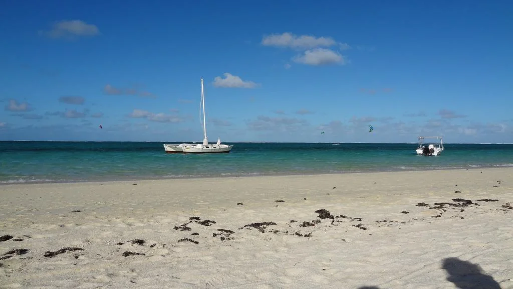
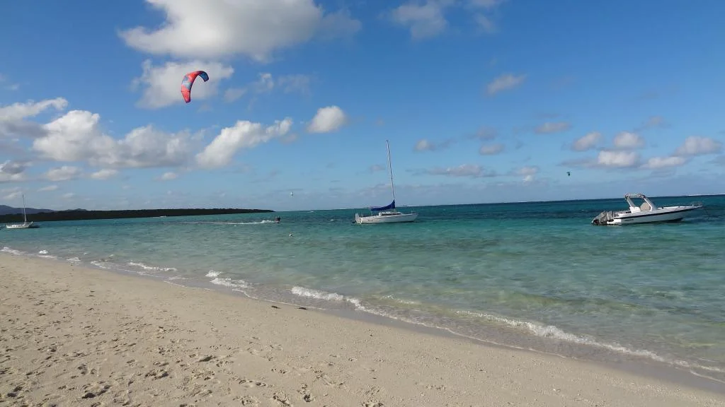
The wind that bothers some is a boon for others: the east coast is a playground for watersports in Mauritius. Windsurfers and kitesurfers find consistent conditions for much of the year, with a wide, shallow lagoon that allows for safe sailing, particularly between Belle Mare and Palmar and near Poste Lafayette. Schools and rentals are most often provided through hotels, including for non-guests.
For snorkeling, the east coast requires a bit of planning: the lagoon is vast, the seabed near the shore is often covered in seagrass, and the waves can easily pick up when the trade winds arrive. The best outings are early in the morning, before the wind picks up, or by boat to more sheltered areas. General principles and precautions are outlined in the guide. snorkeling in Mauritius.
Finally, the sea beyond the reef is noticeably rougher here than on the west coast. Mauritian weather forecasts regularly advise against venturing out to sea during the southern winter, and swimming outside the lagoon is not permitted. There's no need to worry, however: within the reef, the water remains calm and shallow for long distances.
Practical advice
When to come. From November to April, the east coast is probably the best on the island: the wind tempers the heat instead of overwhelming it. From June to September, you need to be comfortable with the wind and bring something to cover up with in the late afternoon, even on sunny days. May and October offer the best compromise.
Move. There are no motorways on this coast: you travel on the coastal road and secondary roads, often beautiful but slow. Allow about an hour to reach Port Louis from Belle Mare, and longer during school and work dismissal times. This is the main point to consider: the east is somewhat isolated from the major sites in the west and south, and a short stay here will be compensated for by travel time. A car is practically essential, unless you plan to stay put at your hotel—see the guide to the car rental in Mauritius.
An often overlooked advantage. The international airport is located in Plaisance, five kilometers from Mahébourg, which is at the southern tip of the region. Staying in the southeast for the first or last night saves a lot of fatigue, especially with a night flight.
Where to stay. The east coast is home to many of the island's top-tier establishments, precisely because space and tranquility have been preserved there, and villa rentals are plentiful around Belle Mare, Palmar, Trou d'Eau Douce, and Pointe d'Esny. Conversely, independent dining options are limited: check this before booking. To compare options, see book a hotel or villa.
A one-day itinerary. Early departure from Poudre d'Or (memorial and Spiritual Park), walk in Bras d'Eau Park in the late morning, lunch in Belle Mare, then down to Vieux Grand Port for the fort and museum, and late afternoon in Mahébourg. All these places can be located on the map. map of tourist sites and activities.
Frequently Asked Questions about the East of Mauritius
Where does the east of Mauritius begin and end?
The east coast of Mauritius stretches from Poudre d'Or in the northeast to Pointe d'Esny in the southeast. It covers the seafront of the Flacq and Grand Port districts. Beyond Pointe d'Esny begins the south, with Blue Bay and Souillac; north of Poudre d'Or, one enters the north of the island, around Grand Gaube and Cap Malheureux.
Is the east coast really windier?
Yes, the east of Mauritius receives the trade winds first, unobstructed, and the wind is present there almost every day during the southern winter, from May to October. In summer, it blows less strongly, making the heat significantly more bearable than elsewhere. However, the exposure varies from beach to beach depending on the coastline.
What are the most beautiful beaches in the East?
Belle Mare and Palmar form the longest stretch of white sand on the island, with a wide lagoon and casuarina trees. Pointe d'Esny, to the south, offers very calm and shallow water. bras D'Eau and poste Lafayette Are better suited for a stroll than a day of swimming, as the wind is stronger there.
Which islands can be visited in the Southeast?
Grand Port Bay boasts several islets that can be visited by boat from Mahébourg or Blue Bay, usually included in the so-called "Five Islands of the Southeast" cruise: Île aux Fouquets with its ruined lighthouse, Île de la Passe with its 1810 fortifications, and Îlot Vacoas, renowned for its snorkeling. Île aux Aigrettes, opposite Pointe d'Esny, can be visited separately, only as part of a guided tour booked in advance.
Do you need a car to stay in the east?
A car is highly recommended in the east of Mauritius. Apart from hotels, restaurants and shops are scarce around Belle Mare and Palmar, and the main attractions in the west and south are an hour's drive or more away. Without a vehicle, a stay in the east is practically limited to your hotel and its immediate surroundings.
What to see in the east in one day?
A full day in the east allows you to visit the Saint-Géran memorial in Poudre d'Or, hike in Bras d'Eau National Park, explore Belle Mare beach, see the ruins of Fort Frederik Hendrik in Vieux Grand Port, and visit the center of Mahébourg. Île aux Cerfs and the Grande Rivière Sud-Est waterfall alone require a full day.
Is the east suitable for a first stay in Mauritius?
The east is well-suited for a stay where you primarily remain in one place, thanks to its spaciousness, tranquility, and the quality of its beaches. However, for a first short trip where you want to see as many sites as possible, the region's remote location and travel times are drawbacks. This issue is addressed in detail in the guide on the... coast to choose for your holidays in Mauritius.
What is the historical significance of the east Coast?
The east coast is home to the birthplace Of Mauritius: it was In Vieux Grand port that The dutch settled in 1638, On the site of the island's first permanent european settlement, and it was in grand port bay That The only french naval victory commemorated On the arc de triomphe took place in august 1810. Mahébourg, Its museum, and the rault biscuit Factory complete this heritage.



The information in this article is provided for guidance purposes only. The author and publisher accept no responsibility for the accuracy of the information provided. It is recommended that you verify the information directly with local operators or the relevant Mauritian authorities during your stay. See the Terms (Article 12).
(The photos you send will only be used to complete this page and will never be used commercially outside of this site without your permission)
To share photos of your vacation in Mauritius with your friends, family and colleagues, we offer to create for you a personalized and free page dedicated to your stay. You will then just need to send the address of this page, for example www.ilemaurice-im/vacancesdepierreetmarie, to those with whom you wish to share your photos.
Nothing could be simpler, click on the button below.
Info +:
Rent a car
Book hotel or villa
Buy a plane ticket
7 day Weather forecast
Bus routes: Click here
Your advertising on this page?
Want to display an ad for your business on this particular page (or elsewhere on the site)?
Please contact us in click here.
Contribute, improve this page
We want to provide the most relevant and complete information to internet users, so if you want to add something or modify this page (text, Photo, etc.), Or even report an error, do not hesitate to contact us by sending us an email to the following Address: contribuer@ilemaurice.im
(remember to clearly indicate the page concerned by your contribution)
(the photos sent will only be used to complete this page and will never be used commercially outside of this site without your consent)
Tested by writing
The east covers a large part of the island; it's a quieter area with fewer things to see or do, but to truly experience the island, you also need to take the time to visit and explore certain places.