
Pieter Both
Pieter Both, the mountain with the stone head
 The essentials in a few words
Pieter Both Is the second highest mountain in mauritius, At 820 Meters, in the moka range which Closes the horizon behind port Louis.
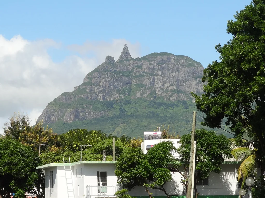
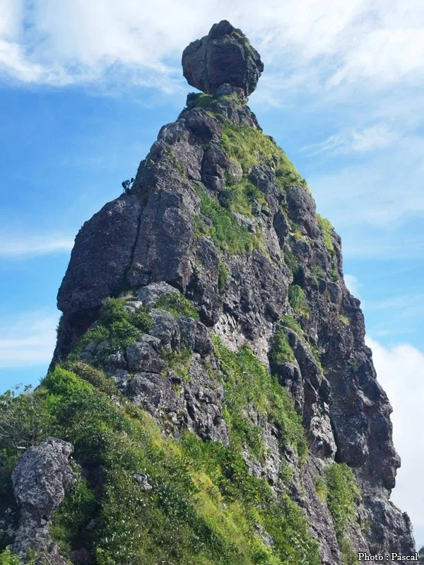
Its signature feature: a sharp, rocky peak topped with a huge rounded block about nine meters in diameter, which everyone calls "the head". It is very visible from the road, especially from the M3 motorway between Terre-Rouge and Verdun, and from the entire Moka region.
Its name comes from a Dutch governor who died at sea off the island in 1615.
The summit rock is the subject of several Mauritian legends, including that of a milkman turned to stone by fairies.
The ascent exists, but it is a supervised climbing activity.
There are mountains you discover by climbing them. Pieter Both, however, is visible even before you know its name. A broad, rounded massif, perched above the Moka plain, with a slender peak on its flank, topped by a rounded block—a head on shoulders. Once you've spotted it, you look for it everywhere: from the highway, from a garden in Moka, from the nearby summit of Thumb. It's the most recognizable profile of themAURITIUS, even before the lagoons.
This article is not a hiking guide. Pieter Both can be climbed—with difficulty, ropes, and a guide—but the vast majority of visitors will never ascend it, and don't need to. What follows is for those who do admire it: where to see it from, what the rock at the summit actually is, the origin of its improbable Dutch name, the stories Mauritians have attached to it, and why botanists worldwide are familiar with its slopes.
Summary
- What does pieter both really Look Like?
- Where to see the Pieter Both without climbing it
- A mountain born from a vanished volcano
- Who was Pieter Both, and why is his name here?
- The legends of the rock
- The first ascents
- Can we go up there today?
- The rarest palm tree in the world grew here
- Pieter Both in its setting: the Moka chain
- Frequently asked questions about Pieter Both
- Photos
What does pieter both really Look Like?
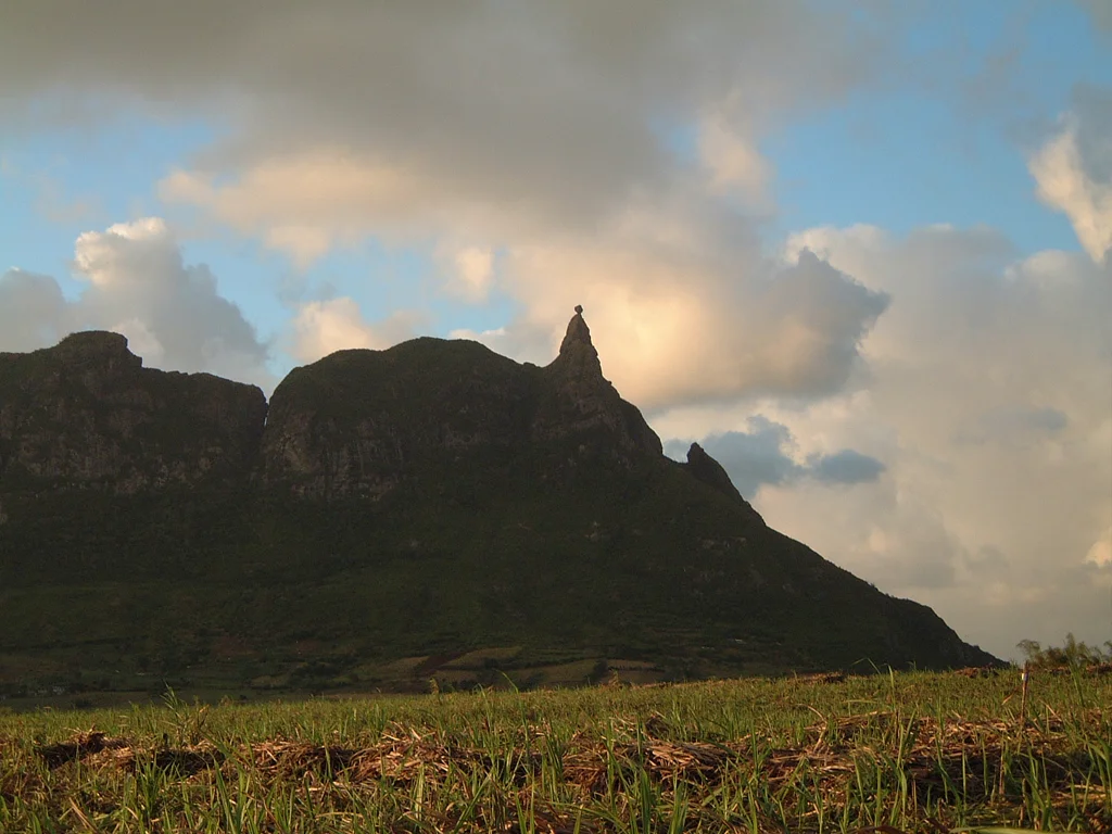
It's not a sphere balanced on a dome, as is often described. The summit of Pieter Both is a narrow, pointed rocky peak—a neck—surmounted by a rounded block that is significantly wider. The whole structure doesn't rise in the middle of the mountain but on the shoulder of a broad, domed, verdant massif, whose flanks are striated with gray rock bands. It is this disproportion between the block and the peak that creates the effect of a head resting on shoulders, and it is this disproportion that makes the silhouette impossible to mistake for any other.
The summit rock
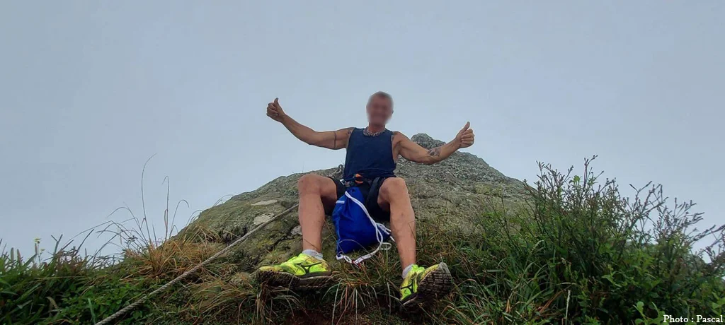
The terminal block measures approximately nine meters in diameter. Its upper face is flat and barely more than two meters wide: the "summit" of Pieter Both is this tiny platform, overhanging on all sides. Metal bars have long been fixed to it to allow passage over the final wall. Seen from below, the rock appears precariously balanced; it is in fact integral to the mountain, and it has been there for far longer than the stories told about it.
Why does it change shape depending on where you look at it from?
Because the block isn't spherical and the peak on which it stands is very narrow, the silhouette changes dramatically from one viewpoint to another. From a distance and at a three-quarter angle, the head is clearly visible. From the front, it becomes more refined and resembles a raised finger or a flame. And from the very base of the mountain, it almost disappears: only a ridge is visible. This is why Pieter Both is photographed from a distance, never at its base—and it's also why some visitors, upon arriving in the village of La Laura, wonder what happened to the famous head.
Where to see the Pieter Both without climbing it
The best view from the road is along the M3 motorway, between Terre-Rouge and Verdun. This route runs along the foot of the Moka range, showcasing the Pouce and Pieter Both peaks along long, straight stretches. Many travelers discover the mountain in this way, without having sought it out, while driving north or towards Ébène. It's a driver's perspective: you should plan to stop elsewhere to admire it at your leisure.
From the Moka region
The entire Moka plain faces the mountain head-on. The newer neighborhoods around Saint-Pierre, Telfair, and L'Avenir were built directly opposite the range, and the Pieter Both is a constant landmark in the daily landscape. It is on this side that the light is most generous at the end of the day, when the sun illuminates the west-facing slopes and highlights the rocky outcrops. center of the island offers several of these escapes without the need to look for a specially designed viewpoint: a country road, a cane field, a gap between two houses is enough.
From the village of La Laura-Malenga
This is the closest point accessible by car. Laura-Malenga is a village in the Moka region, at the very foot of the mountain, and it's from its stadium that hikers set off. Here, you're in close contact with the terrain, surrounded by farms, fields, and narrow roads. Paradoxically, it's also the place where the famous peak is least visible: too close, too far below. The experience here is worthwhile for the scale of the massif, not for the postcard view.
From Port Louis and its heights
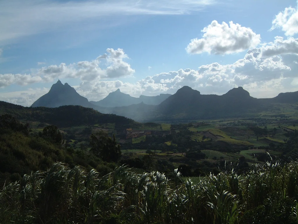
The Moka chain traces a semicircle around Port Louis, and the capital literally lives in this amphitheater of mountains. From the city's highest points — the fort Adelaide Citadel in particular, the entire rocky arc is visible. Le Pouce, with its upright thumb, is the most immediately identifiable peak; Pieter Both lies further east. A useful detail for photographers: viewed from Port Louis, one is looking east, therefore backlit in the morning and in full sunlight in the afternoon.
From the summit of the Thumb
This is the most spectacular viewpoint, and it's accessible on foot without equipment. Le Pouce, the island's third highest peak at 812 meters, is climbed via a hiking steep but without technical difficulty, it faces the pieter both. From There, You can see the summit clearly, in profile, with the plain and the sea behind. for those Who want to Truly "see" The pieter Both, This is the most worthwhile option: the effort of a Climb, with no risk of rock climbing.
A precaution before traveling
The Moka range is prone to cloud cover. It's not uncommon for the plains to be clear while the peaks remain shrouded in clouds, or for a bank of clouds to roll in and hug the slopes within minutes. If your goal is to see the summit of Pieter Both, it's best to take a look at the mountain before making the detour and be prepared to return another day. The same day might offer a perfectly clear summit in the morning and one that's completely invisible by midday.
A mountain born from a vanished volcano
Pieter Both rises to 820 meters, making it the second highest peak in Mauritius, after Piton de la Petite Rivière Noire at 828 meters—a difference of only eight meters. Some Mauritian sources suggest 823 or 824 meters; the figure of 820 meters is by far the most commonly accepted. Its coordinates are approximately 20°11′32″ S and 57°33′19″ E, in the Moka district.
The mountain belongs to the Moka range, formed some ten million years ago from a basaltic lava dome. This range describes a semicircle around Port Louis, and it is this arc shape that holds the key to the Mauritian landscape: the island's mountains are not a folded chain but the eroded remains of ancient volcanic edifices, whose hardest parts survived when everything else was swept away. The summit peak of Pieter Both is precisely this—a core of compact rock exposed by erosion, not a block that fell from nowhere. The same mechanism, on different scales and at different ages, explains the volcanic landforms found elsewhere on the island, from the Deer Hole to the gorges of the southwest.
A detail that connects the mountain to the coast: the Tombeau River originates on its slopes and flows into the bay of the same name, north of Port Louis. We will see later that this is not a mere coincidence.
Who was Pieter Both, and why is his name here?
Pieter Both was the first Governor-General of the Dutch East Indies, and he died at sea off the coast of Mauritius on March 6, 1615. The mountain bears his name in memory of this shipwreck. It is one of the few Mauritian place names that dates directly back to the very brief Dutch presence in the country.history of the island.
The man
Born in Amersfoort in 1568, Pieter Both took command of the Dutch East India Company in Asia in 1610. He founded Batavia, present-day Jakarta, negotiated with the Moluccas, and established Dutch sovereignty over Timor and Tidore. In November 1614, he relinquished his position and prepared his return to the Netherlands. He left Bantam at the end of December 1614 with a fleet of four ships—the Banda, the Provinces Unies, the Gelderland, and the Delft—laden with sugar, pepper, cloves, cotton, indigo, and thousands of pieces of Chinese porcelain.
The shipwreck
The fleet stopped at Mauritius, then uninhabited and merely a resupply point on the route to India, in March 1615. A storm arose. Three of the four ships were lost—the Banda, carrying the governor, the Provinces Unies, and the Gelderland; only the Delft survived. Pieter Both disappeared with the crew of the Banda. Survivors lingered for months on the island before being rescued by a Dutch ship in 1616. The wreck of the Banda was discovered in 1979 by an archaeological expedition, along with part of its cargo of ceramics.
A disputed location
Where exactly did the shipwreck occur? The widely accepted tradition places the tragedy on the reefs of Baie du Tombeau (Tomb Bay), north of Port Louis—hence the bay's name and the apparent connection to a nearby mountain. Several more recent studies, however, place the governor's ship on the west coast, between Albion and Flic-en-Flac, against the rocks of Médine. Some sources also suggest that the name Baie du Tombeau might derive from other burial sites and the sheer danger of these waters.
The consequence is intriguing: if the second version is correct, Pieter Both may never have laid eyes on the mountain that bears his name, the visible landscape from Flic-en-Flac being more that of the Rempart. We can therefore consider the man, his role, the date, and the shipwreck established; the precise location, however, remains a subject of debate.
The legends of the rock
The summit block has inspired at least three folk tales, passed down orally long before being written Down. they all stem from the Same observation: this rock shouldn't be standing there.
The witch turned to stone
The shortest version claims that the rock is a petrified witch, frozen for eternity at the mountain's summit. It was passed around during evening gatherings and served both to explain the shape and to impress children.
The milkman and the fairies
The most elaborate version tells of a very poor milkman who lived deep in the valley. While out fetching milk, he lost his way in the forest at nightfall, lay down at the foot of a rock, and fell asleep. Fairies appeared to him and offered him the chance to attend a nightly spectacle of songs and dances unlike any mortal had ever witnessed—on the condition that he tell no one. He couldn't keep his mouth shut. The spell was cast, and he was transformed into stone on the mountaintop, condemned to watch over the valley he had never left. It is this legend that gave Pieter Both its popular nickname, Milkman's Mountain.
The Legend of the Slaves
A third story, originating during the British period, claimed that the English would leave the island the day the rock fell. The irony is complete: the rock is still there, and the British left in 1968.
The first ascents
The first known person to reach the summit was a French sailor, Claude Peuthé, on September 8, 1790. The story goes that after several unsuccessful attempts, he used an arrow to loop a rope around the summit boulder and pull himself up, before planting the French tricolor flag. He is said to have climbed back up a few weeks later, in October of the same year, this time accompanied.
For a long time, the British believed they held the record for the first ascent: that of September 7, 1832, led by engineer John Augustus Lloyd with lieutenants Phillpotts, Keppel, and Taylor, who planted a British flag on the summit and published their account in the journal of the Royal Geographical Society. Further expeditions followed in 1848, 1858, and 1864, and metal rungs were cemented into the rock around 1885 to facilitate the final ascent. It is these direct descendants that are still used today.
Can we go up there today?
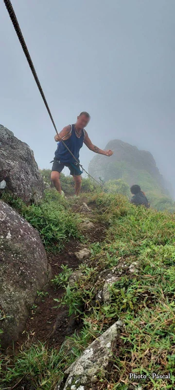
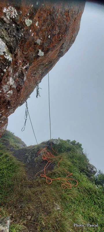
Yes, but this is no longer hiking. The route starts from the La Laura-Malenga stadium and climbs through fields and then scrubland to the shoulder below the summit; up to this point, it's a very steep walk through ravines with often wet and slippery rocks. Beyond this point begins the serious part: an exposed ridge, two steep sections to climb, then the final face of the summit block, crossed using metal rungs of varying condition; a belay rope is essential. Allow a full day in total, with a professional guide—the mountain has claimed victims, and the exposure to the void is real from the beginning to the end of the upper section. If the goal is simply to hike in the mountains of Mauritius with a view at the end, the hiking up Le Morne Brabant or the ascent of the Thumb respond much better to the need.
The rarest palm tree in the world grew here
The slopes of Pieter Both once sheltered Hyophorbe amaricaulis, a palm tree endemic to Mauritius, of which only one individual remains in the world today. It is no longer on the Mountain: it grows in curepipe Botanical Garden, surrounded by a metal scaffolding that protects it and allows access to its crown.
The species has been classified as critically endangered by the IUCN since 1998. The palm tree flowers and fruits regularly, however: it is its seeds that are sterile. This is precisely why botanists need access to its flowers, in order to attempt manual pollination and collect developing inflorescences for in vitro culture. Despite decades of attempts, notably with the National Botanical Conservatory of Brest, no reproduction has been successful. This is why it is called the loneliest plant in the world. The main cause of its disappearance in the wild is deforestation: native vegetation now covers only a tiny fraction of the island.
This story says something about Mauritius that goes beyond the case of the palm tree. The island has lost its dodo and much of its original forest was lost in just a few centuries, and its mountains, too steep to be cleared, became the last refuges of what survived. To look at Pieter Both is also to look at one of these reservoirs.
Pieter Both in its setting: the Moka chain
Pieter Both is not an isolated peak but the highest point of the Moka range, the longest on the island. It contains two of Mauritius' three highest peaks: Pieter Both and Le Pouce (812 m), along with a series of lesser-known peaks—Deux Mamelles, clearly visible from the M3, Mont Ory, Pic Guiby, and Fente Brigitte, located just beside the summit of Pieter Both. Charles Darwin himself climbed Le Pouce during his stopover in Mauritius and recorded it in his logbook.
Nearby, the Moka region boasts several sites that combine well with a day trip to the city center: the château du Réduit, the official residence of the President of the Republic, and higher up on the plateau the curepipe Botanical Garden with its unique palm tree, a stone's throw from the crater of Deer HoleTo locate these points in relation to each other and construct a route, the tourist map of Mauritius remains the simplest option.
Frequently asked questions about Pieter Both
What is the height of Pieter Both?
820 meters. This is the value accepted by the vast majority of sources, although some mauritian publications indicate 823 or 824 meters.
Is Pieter Both the highest peak in Mauritius?
No, the second one. The Piton de la Petite Rivière Noire, in the southwest, surpasses it by eight meters at 828 meters. Pieter Both, however, remains the more recognizable of the two, by far.
Where is the best view Of Pieter Both?
From the M3 highway between Terre-Rouge and Verdun for a road view, from the Moka plain for a more leisurely view, and from the summit of Le Pouce for the most panoramic view. Avoid the base of the mountain: that's where you'll see it the least.
Why does the rock at the summit look like a head?
Because a rounded block about nine meters in diameter rests on a much narrower rocky peak. It is this difference in width that creates the illusion of a head resting on a neck. The resemblance is only clear when viewed from a distance and at a certain angle.
Is there a risk that the rock at the summit will fall?
It is not balanced precariously but attached to the mountain, and it has occupied this position since geological times. The image of the rock about to topple is a product of perception and legend, not of the actual geological structure.
Is it possible to climb Pieter Both without a guide?
This is strongly discouraged. The upper section involves rock climbing, with exposed passages, slippery rocks, and metal rungs of varying ages. A professional guide and rope are considered essential to reach the summit.
How long does the climb take?
Allow a full day from La Laura-Malenga, including the round trip. The summit section alone, along the ridge, takes about an hour, but it represents only a fraction of the total time and all the technical difficulty.
Did Pieter both die at the foot of his Mountain?
It's not certain. Tradition places his shipwreck at Tomb Bay, very close by, but other studies place it on the west coast, between Albion and Flic-en-Flac. In that case, the governor would never have seen the mountain that bears his name.
Is the visit suitable for Children?
To admire the mountain, yes, without hesitation: it's a scenic feature, visible from the road and throughout the Moka region. But to climb it, no — the upper section is not suitable for children or those prone to vertigo.
The information in this article is provided for guidance purposes only. The author and publisher accept no responsibility for the accuracy of the information provided. It is recommended that you verify the information directly with local operators or the relevant Mauritian authorities during your stay. See the Terms of Use (Article 12).
(The photos you send will only be used to complete this page and will never be used commercially outside of this site without your permission)
To share your Mauritius vacation photos with friends, family, and colleagues, we offer a free, personalized webpage dedicated to your trip. Simply share the webpage address, for example, www.ilemaurice-im/vacancesdepierreetmarie, with anyone you'd like to share your photos with.
It's very simple, just click on the button below.
More information:
Rent a car
Book a hotel or villa
Buy an airplane ticket
Free
7-day weather forecast
Walking and hiking
Bus routes: Click here
Your advertisement on this page?
Do you want to display an advertisement for your business on this particular Page (or elsewhere on the Site)?
Thank you for contacting us by click here.
Contribute to and improve this page
We want to provide internet users with the most relevant and complete information, so if you would like to add to or modify this page (text, photo, etc.), or even report an error, please do not hesitate to contact us by sending an email to the following address: contribuer@ilemaurice.im
(remember to clearly indicate the page to which your contribution relates)
(The photos you send will only be used to complete this page and will never be used commercially outside of this site without your permission)