
religion-spirituality / Beach / Village
Cap Malheureux
Cap Malheureux: The jewel of northern Mauritius and its legendary red-roofed church
 The essentials in a few words
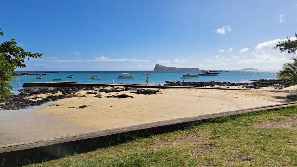
Cap Malheureux is a fishing village on the northern tip of Mauritius, in the Rivière du Rempart district. It owes its fame to the Notre-Dame Auxiliatrice church, recognizable by its scarlet red roof, standing facing the lagoon with the islet of Corner of the Sight clearly visible offshore. A small beach bustling with fishing boats completes the scene. It was also here that British troops landed in 1810, a pivotal moment in Mauritian history. The village is about fifteen minutes from Big Bay.
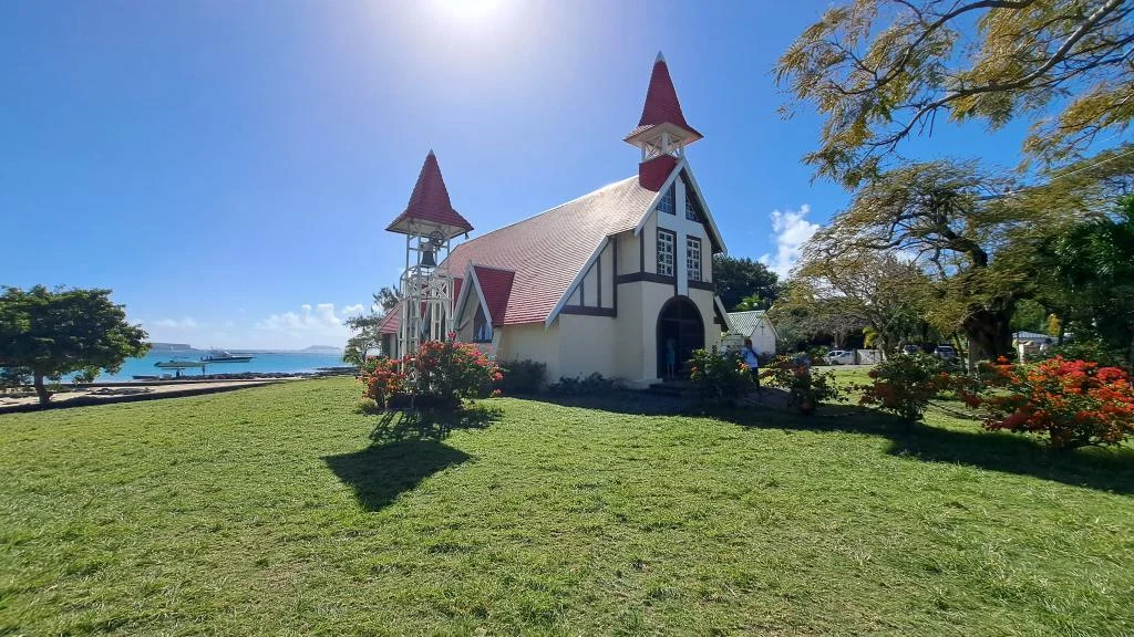
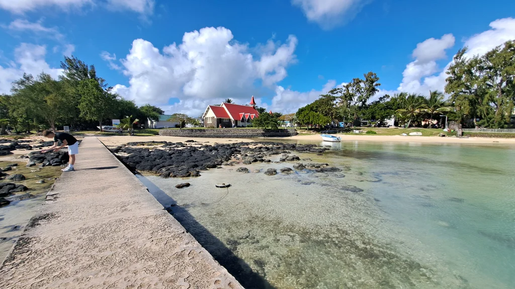
In the far north of Mauritius, Cap Malheureux is one of the island's most photographed villages. Its somber name contrasts sharply with the picture-postcard scene it presents: a small church with a scarlet roof overlooking the turquoise lagoon, with the islet of Coin de Mire in the background. Despite its name, there's nothing unhappy about the atmosphere: it's a peaceful fishing village, far from the hustle and bustle of Grand Baie, where people come mainly to admire the scenery, take photos, and simply relax.
Between its history linked to the British landing of 1810, its church which has become one of the visual symbols of Mauritius and its tranquil beaches, Cap Malheureux can be visited in a little over an hour, but deserves to be lingered a little longer if the late afternoon light is suitable.
Summary
Where does the name cap Malheureux Come From?
Two explanations circulate regarding the name Cap Malheureux. The first, the best documented by historical sources, links it to the landing of British troops in 1810. The second, more popular but less solidly attested, evokes the numerous shipwrecks that occurred over the centuries off this coast, whose coral reefs long represented a real danger to navigation.
The british landing of 1810
After their naval defeat at the Battle of Grand Port in August 1810, the British retreated to Rodrigues Island to prepare a new offensive against Île de France (Mauritius), then a French colony. On November 29, 1810, an invasion fleet of about sixty transport ships and thirty warships, totaling nearly ninety vessels, positioned itself offshore between Coin de Mire and Anse du Mapou, west of Cap Malheureux. French sources attribute the landing to Cap Malheureux itself; the most detailed English-language historical accounts, however, place the landing point more precisely at Grand Baie, the neighboring bay.
The landing of some 10,000 British and Indian soldiers began in the early afternoon and proceeded without significant resistance: detailed accounts report only two casualties, both due to natural causes. In the late afternoon, the troops began their advance towards Port Louis, renamed Port Napoleon in 1806 by Governor Decaen in honor of the Emperor, and by 8:00 p.m., all the men, with their weapons and baggage, had set foot on Mauritian soil. The first skirmishes with French troops took place the following day, further south near the Rivière du Tombeau, before a larger battle north of the capital on December 1st, resulting in approximately sixty French deaths and around 150 British casualties.
Faced with numerical inferiority, the French governor Charles Decaen capitulated on December 3, 1810. Île de France then definitively passed under British rule and reverted to its former name of Mauritius. This decisive episode, which would seal the end of more than a century of French presence on the island, is said to have given the cape its melancholic name. A commemorative stele, erected on the bain Bœuf public beach very close, recalls this event today.
Originally, a simple fishing village
Long before and long after this military episode, Cap Malheureux remained a modest fishing hamlet. Daily life there was punctuated by the comings and goings of wooden boats and the drying of nets in the sun, families living primarily off the sea. It was only over the decades, with the rise of tourism on the north coast, that the village began to attract visitors, without losing its identity as a fishing community, which remains very much alive today.
The Church of Our Lady Help of Christians, a symbol of the north of the island
The village's main attraction, and one of the most recognizable images of the entire island of Mauritius, is the small Catholic church of Our Lady Help of Christians. Its construction was initiated by Father Albert Glorieux, a Belgian missionary and parish priest of the neighboring parish of Grand Gaube. The building was designed by Max Boullé and constructed by Raoul Lolliot, before being consecrated on August 7, 1938, by Monsignor Richard Lee, Vicar General.
A simple yet instantly recognizable architectural style
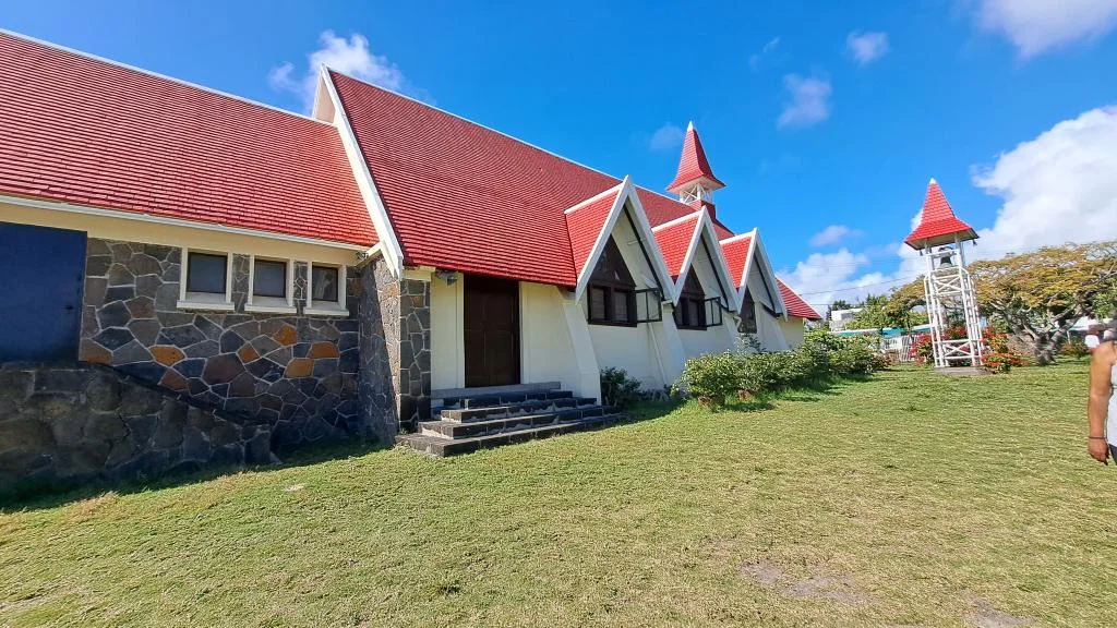
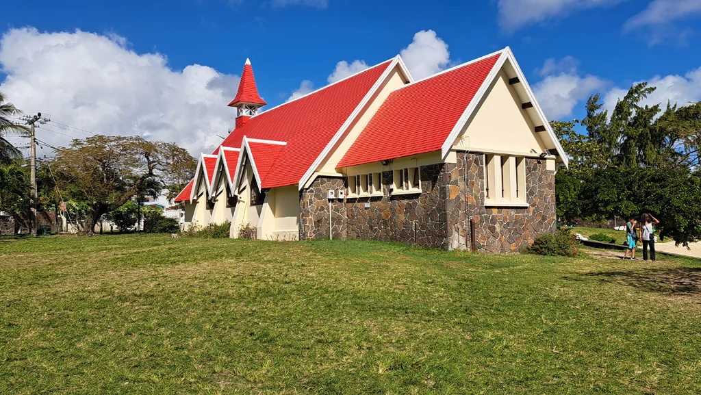
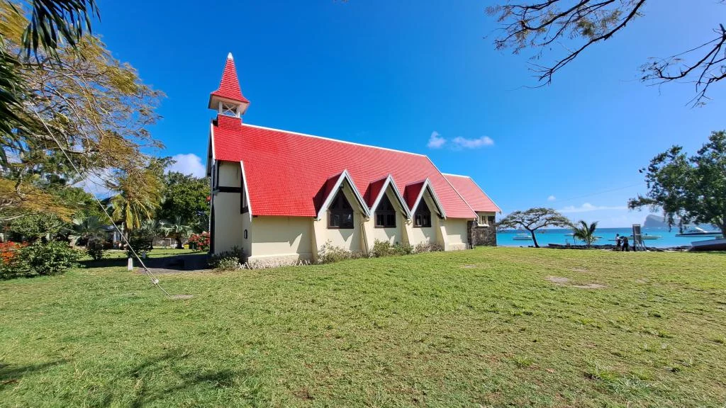
The church is distinguished by its modest yet refined architecture, typical of Mauritian religious buildings of the period: white walls, dark-framed windows, and above all, a shingled roof painted a vibrant red, which contrasts magnificently with the blue of the lagoon and the green of the surrounding vegetation. On the side of the building, three pointed dormer windows with the same red shingles punctuate the roofline, each sheltering a window. On the road side, a single bell tower rises above the entrance: a bell visible in a white, openwork case, topped by a red-shingled spire on a brick base. Its size remains intimate, the building accommodating about a hundred worshippers.
Built directly facing the sea, the church offers an unobstructed view from its forecourt of the turquoise lagoon and the islet of Corner of the SightA few kilometers offshore and easily recognizable by its massive silhouette. It is this composition, church in the foreground and ocean stretching to the horizon, that makes it one of the most sought-after photographic subjects on the island.
A place of worship that is still active
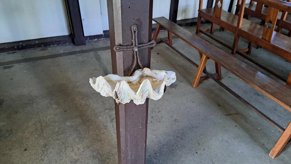
Unlike other purely touristic monuments, Notre-Dame Auxiliatrice remains a working church. It regularly hosts religious services, weddings, and baptisms, with a particularly large crowd attending Sunday Mass. Visitors can generally enter freely outside of ceremonies, provided they respect the space and the silence expected in an active religious building. Inside, the simple and unadorned interior features an unusual holy water font: a large, mother-of-pearl shell fixed to a wooden pillar, which serves as a basin for holy water.
The beach and the fishing village
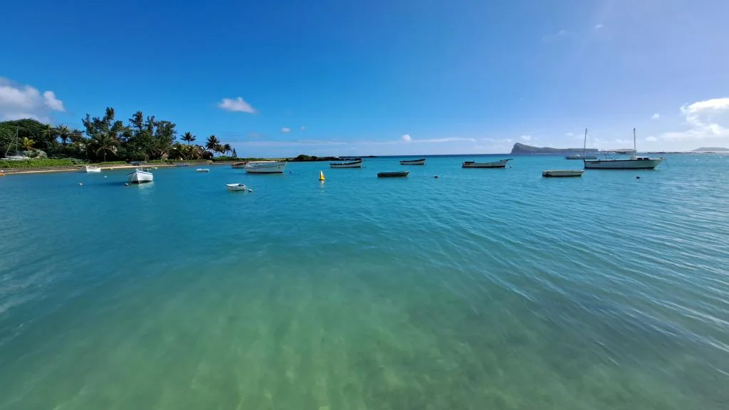
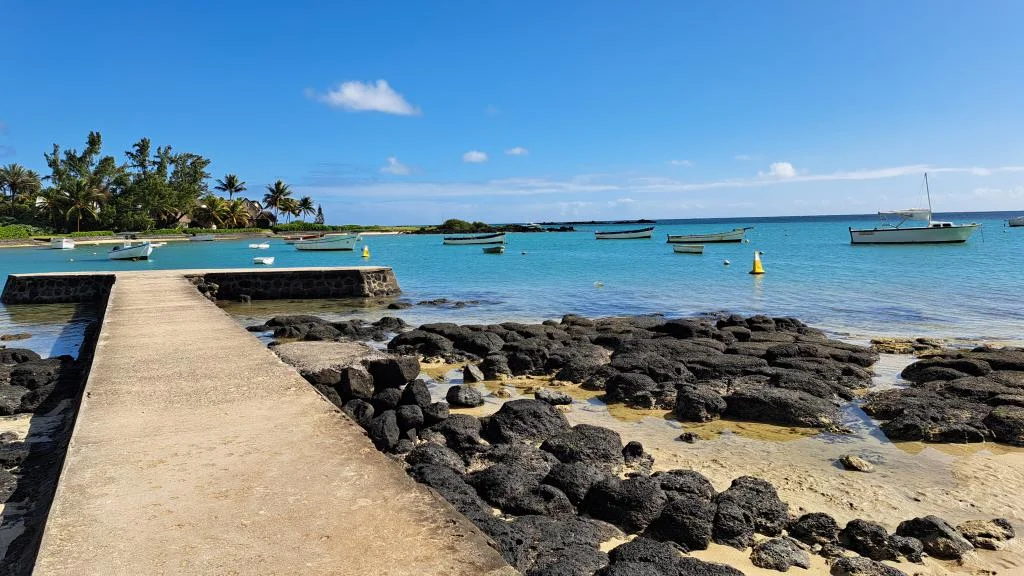
Just in front of the church lies a small public beach, modest in size but Full of character. it is here that local fishermen moor their colorful canoes, offering a glimpse into Authentic daily life: early morning departures before sunrise, returns in the late afternoon with the day's catch, sometimes sold directly on the sand to curious visitors.
Swimming is possible there, in calm and shallow water, but the beach is not designed as a day-long leisure destination: it lends itself rather to a short break, a refreshing swim or waiting until sunset, when the golden light on Coin de Mire and the boats at anchor offers one of the most beautiful spectacles on the north coast.
For a truly relaxing day, two neighboring beaches take over: the bain Boeuf public beach, more extensive and calmer, or that of Pereybere, a little more crowded but very popular for its turquoise waters.
Tips for photographing the church
Cap Malheureux is visited primarily to leave with a photo of its red-roofed church, and a few landmarks allow you to obtain a much better result than a simple minute stop in the parking lot.
- The morning : In the mid-morning, the sky is generally clear and the vertical light brings out very saturated colors, the red of the roof against the clear blue of the lagoon.
- The sunset Another type of photo, focusing less on the building's bright colors and more on the atmosphere. The sky blazes behind the silhouette of the church and the anchored boats, creating a more intimate feel than the morning's postcard.
- The best angle The classic view is taken from the lawn opposite the church, which frames the entire building with the lagoon and Coin de Mire in the background. Going down to the water's edge or slightly at an angle allows for a different composition and the inclusion of fishing boats moored nearby.
- Avoid the world : arriving early in the morning or After 4 p.m. generally allows for a quieter site for composing your photo.
- Inside : some details are worth a look for those entering the church, such as the large seashell holy water font fixed on one of the wooden pillars, which serves as a basin for holy water.
Frequently asked Questions
Why is Cap Malheureux called that?
The best-documented explanation dates back to the landing of British troops on November 29, 1810, which led to the French surrender a few days later and the end of the French presence on the island. Another, more popular explanation involves shipwrecks that occurred on the reefs off this coast over the centuries.
What is there to see in Cap Malheureux?
The main attraction is The Notre-Dame auxiliatrice church with its distinctive red roof, overlooking the lagoon and the Islet of Coin De mire. the village itself, with its small beach and fishing pirogues, completes the visit.
Is it possible to visit the Notre-Dame Auxiliatrice church?
Yes, the church is generally freely accessible outside of religious services. It is an active place of worship: respectful dress and behavior are expected, especially during ceremonies.
When is the best time to photograph the Church?
It depends on the type of photo you're looking for. Mid-morning generally offers clear skies and highly saturated colors, the red of the roof against the blue of the lagoon. Sunset gives a completely different, more intimate feel, with the silhouette of the church standing out against a fiery sky.
How much time should I allow for a visit to Cap Malheureux?
Thirty minutes to an hour is enough to explore the church and the village. Allow more time if you plan to watch the sunset or enjoy the beach.
How to get to Cap Malheureux from Grand Baie?
Cap Malheureux is about a 10-15 minute drive from Grand Baie, by rental car or taxi.
Is it possible to swim at Cap Malheureux?
Swimming is possible in calm water, but the beach is rather small. For a relaxing day, the nearby beaches of Bain Boeuf or Pereybère are better suited.
The information in this article is given for information purposes Only. the author and publisher assume no responsibility for the accuracy of The information mentioned. it is recommended to verify information directly with local operators or the relevant mauritian authorities during your stay. See the Terms (Article 12).
(The photos you send will only be used to complete this page and will never be used commercially outside of this site without your permission)
To share your Mauritius vacation photos with friends, family, and colleagues, we offer a free, personalized webpage dedicated to your trip. Simply share the webpage address, for example, www.ilemaurice-im/vacancesdepierreetmarie, with anyone you'd like to share your photos with.
It's very simple, just click on the button below.
Info +:
Rent a car
Book a hotel or villa
Buy an airplane ticket
Opening Hours: free access
Free
7 day Weather forecast
Walk
Accessible child and stroller
Accessible to wheelchairs
Parking
Nearby catering
Bus routes: Click here
Your advertising on this page?
Do you want to display an advertisement for your activity on this particular Page (or elsewhere on the Site)?
Please contact us in click here.
Contribute, improve this page
We want to provide the most relevant and complete information to Internet users, so if you want to provide additional or modification to this page (text, photo, etc.), or even report an error, do not hesitate to contact us by sending us an email to the following address: contribuer@ilemaurice.im
(Remember to indicate the page concerned by your contribution)
(the photos sent will only be used to complete this page and will never be commercially operated outside this site without your agreement)
Tested by writing
A very beautiful place in Mauritius, the church is very pretty and original, a must-see.
Not yet tested by the editorial staff
If you would like us to discover this place, this activity, etc., please send us an email to the following address: visiter@ilemaurice.im
How to get to Cap Malheureux
Cap Malheureux is about a 10 to 15 minute drive from Big BayThis makes it an easy day trip from the main tourist hub in the north of the island. From other parts of Mauritius, allow more travel time depending on the distance, as the roads are generally clear outside of peak hours.
The village frequently appears as the final stop on northern tourist routes, associated in particular with pamplemousses Botanical Garden and in Grand Baie. One complete circuit including these three stages allows you to organize a coherent day in the region, ideally ending at Cap Malheureux to enjoy the late afternoon light.
No reservation is necessary to visit the village: simply get there by rental car, taxi or as part of an organized tour.